Skip to content
Free US shipping on all orders
FOLIO
Home
Catalog
Search maps by title, year, or tag
0
All Maps
101 maps
Search
Availability
All
In stock (101)
Out of stock (0)
Sort
Featured
Most relevant
Best selling
Alphabetically, A-Z
Alphabetically, Z-A
Price, low to high
Price, high to low
Date, old to new
Date, new to old
New Boston & Charles River Bay, 1886
From $17.00
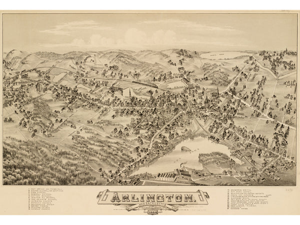
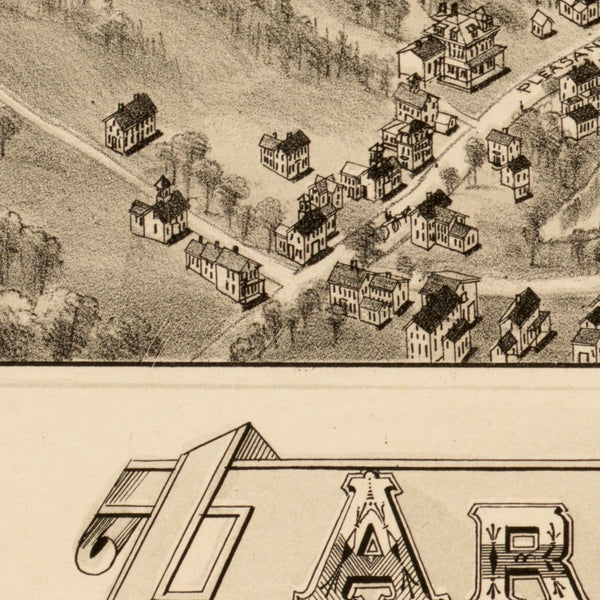
Arlington, 1884
From $24.00
Newburyport, 1880
From $17.00
Copeland's Boston Improvements, 1872
From $17.00
Boston Engineering Plan, 1867
From $24.00
Boston Wards with Charlestown & Cambridge, 1846
From $19.00
Hales' Boston Region, 1829
From $17.00
Boston from the Harbor, 1779
From $17.00
Boston Common & Public Garden, 1901
From $24.00
Boston from the Oldest Authorities, 1893
From $19.00
Mitchell's Boston, 1882
$24.00
Cottage City, Martha's Vineyard, 1880
From $24.00
Boston from Above, 1871
From $21.00
Nanitz' Mercantile Boston, 1869
From $17.00
Boston from Bradford's Atlas, 1838
From $17.00
Boston Vicinity Survey, 1819
From $17.00
Boston Bay (French), 1778
$24.00
Bunker Hill with Burgoyne Letter, 1775
From $17.00
Boston Under Siege, 1775
$24.00
Boston Updated, 1739
From $17.00
Greater Boston, 1909
From $24.00
Boston Elevated Railway, 1910
From $24.00
Charles River, 1900
From $17.00
Downtown Boston, 1896
From $24.00
←
1
2
3
4
5
→